Almere Hout
In the next few years, more than 20,000 plots will be available for private purchase in Almere Hout, an area of fields and forest. Instead of a single development, MVRDV has developed a series of scenarios taking newly planted green areas as a starting point. The development of the overall site will be managed by the municipality but the idea is that through slow development a varied, sustainable and characterful neighborhood will emerge.
- Location
- Almere, Netherlands
- Status
- Design
- Year
- 2006–2006
- Surface
- 20640000 m²
- Client
- Municipality of Almere
- Programmes
- Residential, Master plan
- Themes
- Urbanism
People who want to build their own house in the Netherlands find the process a struggle. In particular, finding a site for their home is a problem. In Almere this problem doesn’t exist: over the next 20 years more than 20,000 plots will be offered for sale to private individuals in the area.
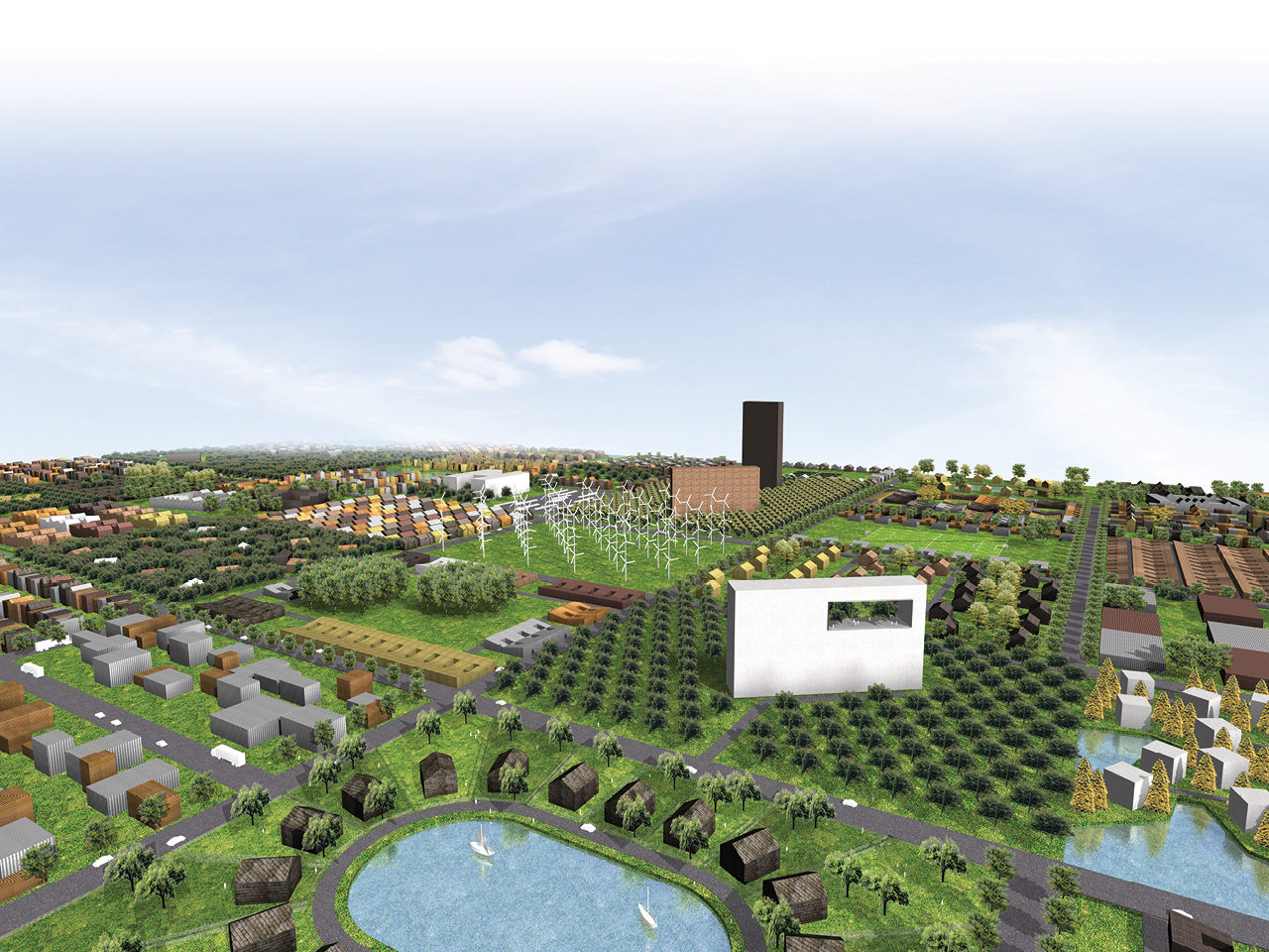
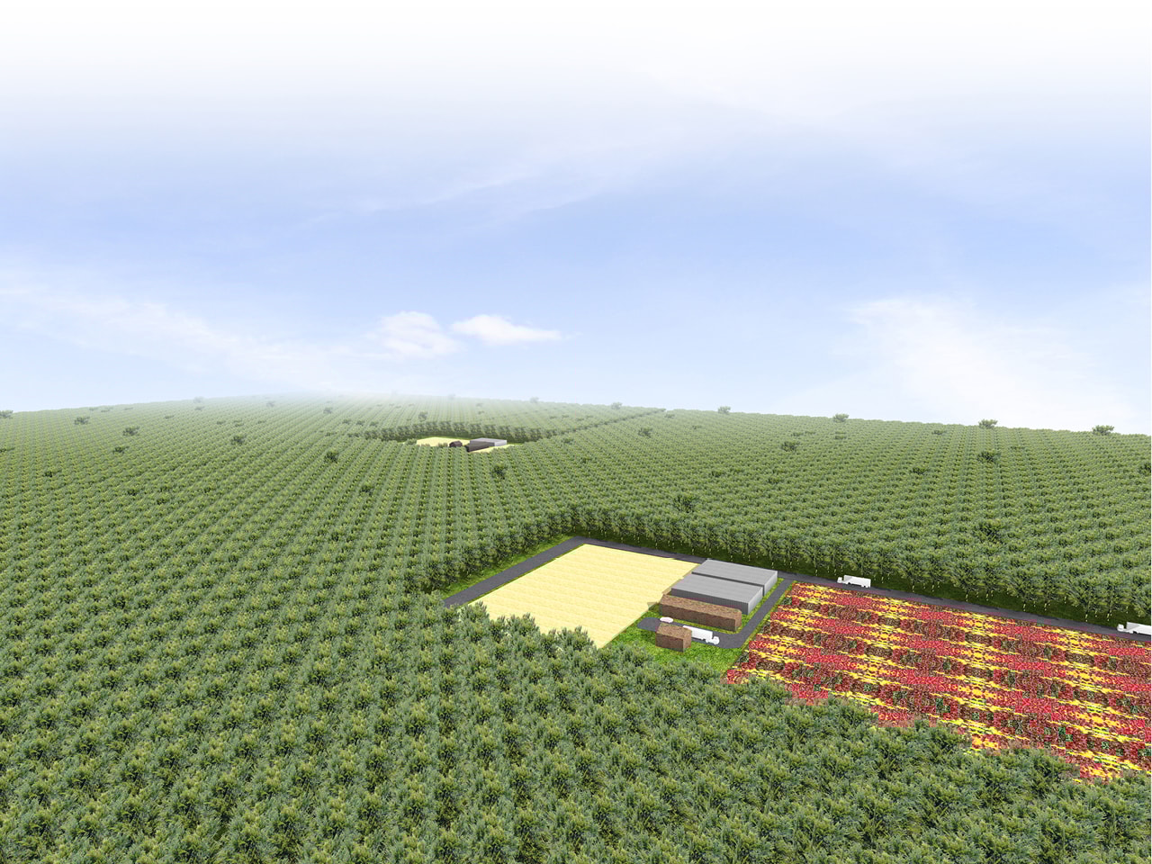
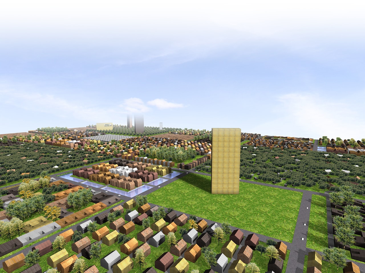
Almere Hout already exists; it is a collection of woods and meadows, where here and there a sprinkling of development exists. On the map, one can see the forest hesitantly beginning to fill the new polders. Most proposals for the area have assumed that a great levelling of sand will occur before development, erasing what is already there to form a tabula rasa for building.
MVRDV’s design poses the question of how to use the existing (natural) qualities of the site. What if a design could be more modest, a path here, the extension of existing forest trails there, paths connecting areas of water and so on. A minimal intervention into nature’s processes, and afforestation, rather than deforestation, as site preparation.
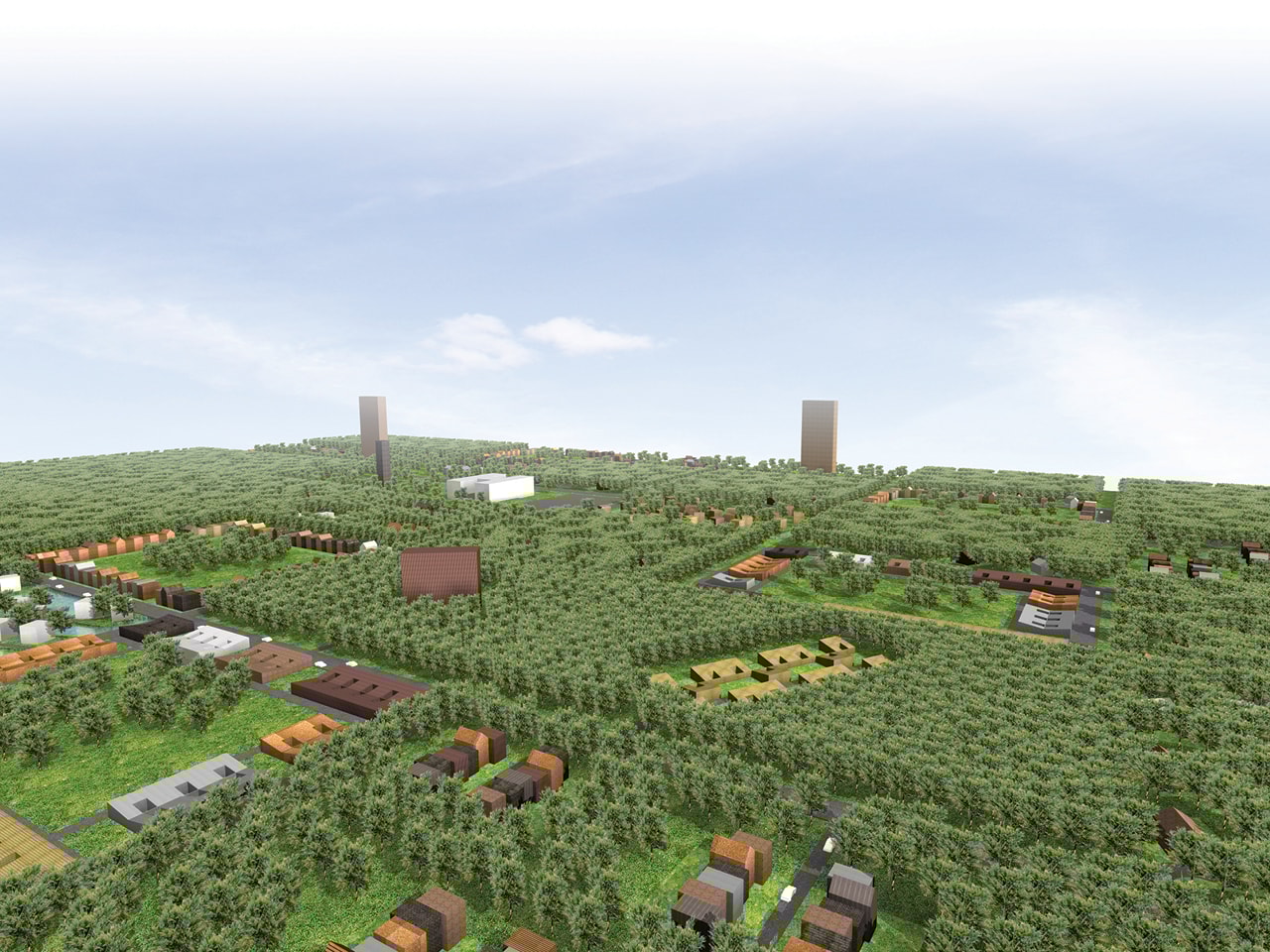
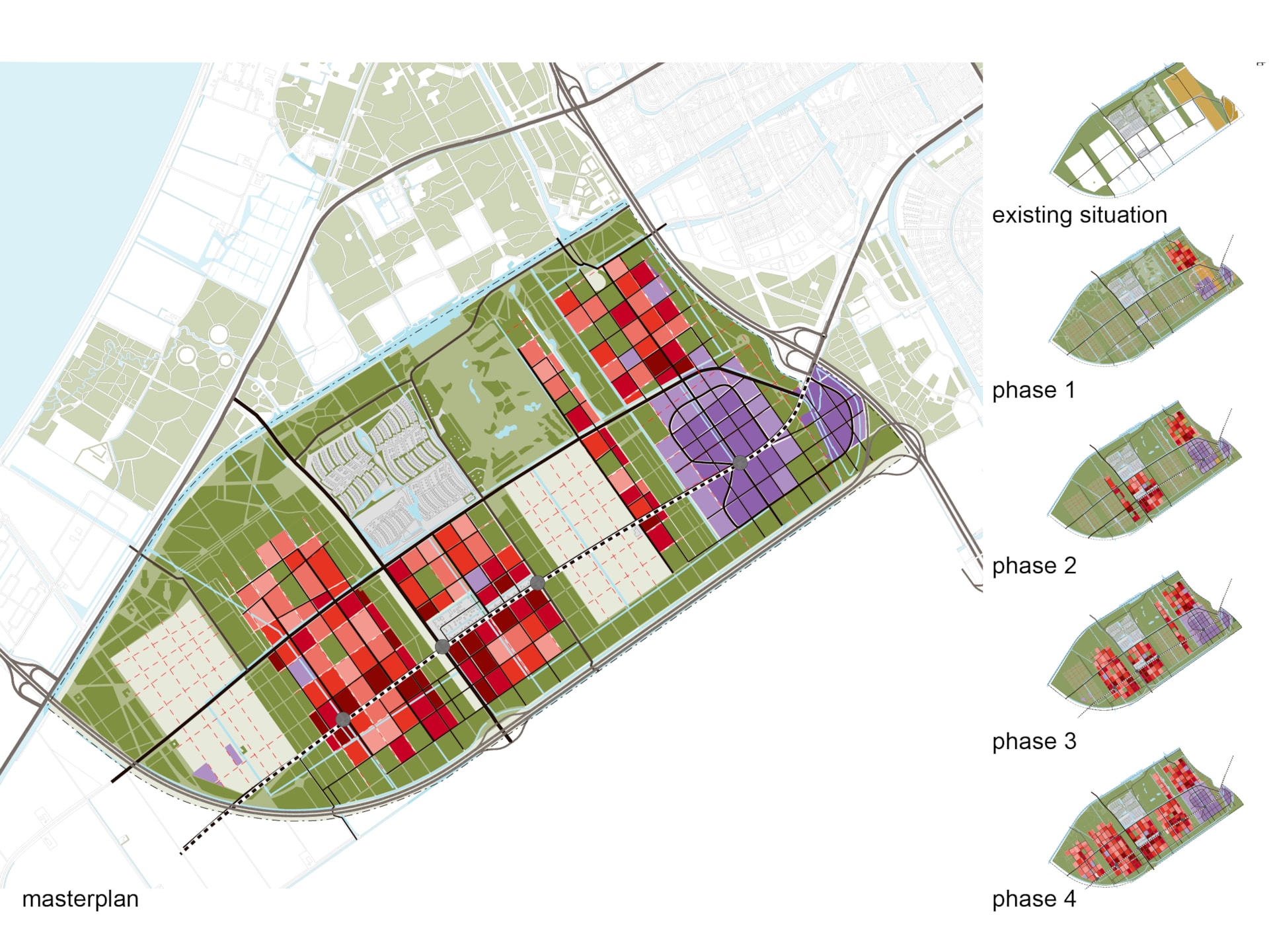
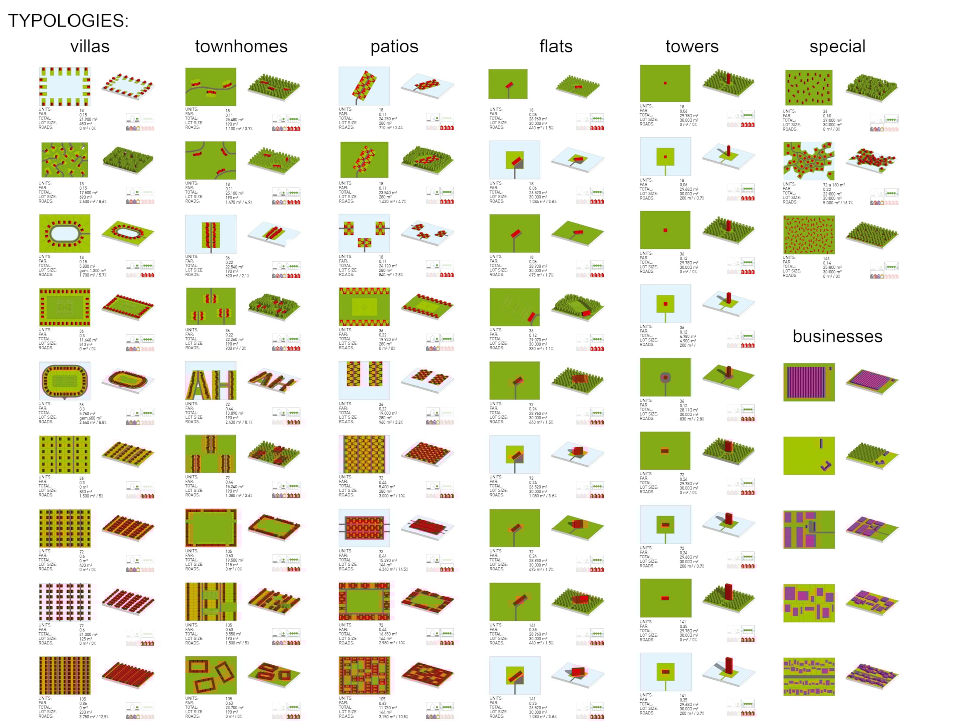
Based on the current area a sustainable grid is projected, to form fields of 150x200m. These fields are in the future the basis for various types of neighborhoods with an average density of 35 dwellings per hectare, but in practice, ranging from very low (6 dwellings / ha) to very high urban densities (45-60 dwellings / ha).
The planted trees may be cut down again to make way for districts for housing, but undeveloped land will remain forest. The aim is to create a generous tapestry of forest that is easy for everyone to reach, and to avoid the scrubby wastelands so typical of newly developed areas. This gives Almere another spatially distinctive development cluster.
By gradually adding roads and infrastructure according to the grid, the municipality can slowly develop the area by replacing greenspace. Within the fields a variety of areas with all possible sizes and shapes of lots might develop. Minimum requirements for building will include a combination of density requirements (number of dwellings per hectare) and job requirements (the mix of living/working, and how productive a field can be).
The rules for density and the decision to open up a new area for development will be the city's main means of control. Additionally, in some fields combinations of building regulations and welfare requirements could be applied. This stimulates the creation of collective identities. In the course of time, both collective and detached housing will arise in Almere Hout.
How to find a lot? Soon future residents can wander among the trees of Almere Hout in search of their favorite spot. They are helped by a series of small fence posts, with the coordinates of the plot indicated. A quick visit back to the Town Hall to register interest in the plot and check its availability; and then…BUILD!
Gallery
.jpg)